Sand Beach to Otter Cliff in Half a Day: The Most Photographed Mile of Acadia
The most-photographed half-mile of Acadia. Pink-sand beach, sea-cave thunder, granite cliff face, and how to time the half-day to do it well.
Two and a half miles of Park Loop Road hold the photographs you’ve already seen of Acadia. Sand Beach. Thunder Hole. Otter Cliff. Otter Point. They sit close enough together that a half-day, run in the right order against the tide, is enough to do all four properly, and most visitors don’t, because they run them in the wrong order or pick the wrong half of the day. The trick is that these four sites don’t share a clock.
Why This Mile Is the One
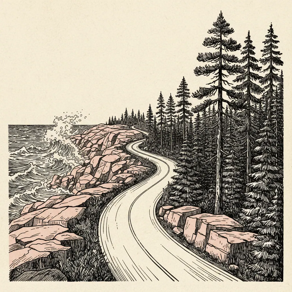
From roughly Mile 6 to Mile 8 of Park Loop Road, the one-way stretch south of Bar Harbor, the road runs along the seaward edge of Mount Desert Island and concentrates four of the park’s signature stops inside a 2.5-mile drive. Sand Beach first. Thunder Hole half a mile later. Otter Cliff a mile beyond that. Otter Point at the bottom of the loop. The mistake is treating them as one stop. They are four stops on three different schedules. Sand Beach wants low tide, when the pink-shell flat is widest and the cold water is held back. Thunder Hole wants the rising tide and a south or east swell, or it is just a wet ledge with a railing. Otter Cliff wants the low sun, sunrise or the last hour before sundown, to throw the 110-foot granite face into relief. Otter Point doesn’t care; the woods loop works any time the road is open. A half-day done in the right sequence beats a full day done out of order, because three of the four windows close before lunch.
The Half-Day Sequence, Hour by Hour
The sequence below is keyed to a July weekday. 5:30 am, Otter Cliff for sunrise. The fenced overlook has a small pull-off that fills within an hour of first light in peak summer. Arrive in the dark and you’ll have it. Arrive at civil twilight and you might not. 6:00–7:00 am, Otter Point loop on foot. A 1.5-mile loop south of the cliff, past the lobster boat anchorage at Otter Cove and a small unmarked WWII observation bunker tucked into the spruce. The light through the stunted coastal forest at this hour is the reason to do it now and not later. 7:30–8:30 am, Sand Beach at low tide. The eastern end of the beach is also the trailhead for the Great Head loop, which is the call if you have an extra forty-five minutes. Either way, you want to be off the sand before the 9:00 lot fills. 9:00–10:00 am, Thunder Hole as the tide turns. This is the window when the cave starts loading. If conditions cooperate, the boom comes in the hour before high tide, not at it. 10:30 am, breakfast at the Thirsty Whale on Cottage Street in Bar Harbor. The kitchen is open by then. The lot you just left is now full.
Sand Beach: The Only One on the East Coast
Sand Beach is one of the few sand beaches on the Maine coast, and the reason it exists is that the sand isn’t really sand. It’s crushed mussel and sea urchin shells, ground down by the surf inside the pocket cove and given a faint pink cast that’s most visible an hour after sunrise. The water is cold. It peaks at around 60°F in late August, the warmest two weeks of the year, and is colder every other week. People swim in it anyway. A lot of people don’t, and the beach itself is the point. Parking is the constraint. After that the Island Explorer shuttle from Bar Harbor (free, runs late June through Columbus Day) is the only practical way in. If the lot is open and the tide is out, walk to the eastern end. The Great Head Trail leaves from there, a 1.5-mile loop along the headland that gives you the best looking-back-at-Sand-Beach photograph in the park, and that most beach visitors don’t realize is right there.
Thunder Hole: When It Actually Thunders
Thunder Hole is the most over-promised stop on Park Loop Road, and the reason is that the boom needs three conditions at once. The mechanic is straightforward. There’s a south-facing granite sea cave with a narrow entrance. An incoming swell pushes a wedge of air into it, the air compresses against the back wall, and when the wave releases, the air punches back out. You hear it. On a good day, it shakes the deck. For that to happen, you need: an east or south wind to drive the swell into the cave’s mouth, waves of roughly 4 feet or larger, and the 1–2 hour window when the tide is rising toward high but hasn’t crested. The NPS posts daily Thunder Hole forecasts at the Hulls Cove Visitor Center; the rangers will tell you straight whether it’s worth your morning. Manage expectations, look at the granite, and drive the mile down to Otter Cliff.
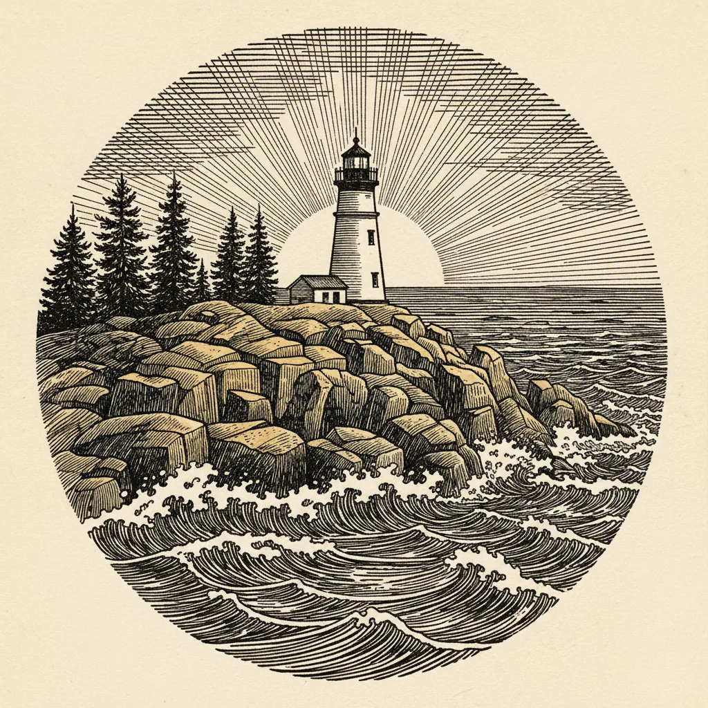
Otter Cliff and the Point Loop
Otter Cliff is the photograph. A 110-foot vertical granite face dropping straight to the Atlantic, the highest headland on the eastern seaboard north of Rio, depending on whose definition you accept, and the only one of the four stops that genuinely needs the sunrise hour or the last hour of golden light to look the way it looks in the postcards. Midday flattens it. The cliff is also a working climbing crag. If you walk the overlook around 9:00 am in summer you’ll often see ropes already rigged at the top anchors. South of the cliff is the Otter Point loop, and it’s the underrated walk on this stretch of road. A mile and a half through stunted, wind-pruned spruce that thins toward the headland; past the lobster boat moorings in Otter Cove; past a small concrete WWII observation bunker, unmarked on most maps, that watched the approach to the Bay of Fundy in the early 1940s. You will share it with a fraction of the foot traffic at Sand Beach a mile north. That’s the loop. Four sites, three clocks, one half-day. Do the order right and you’ll be back in Bar Harbor with a coffee before the day visitors have found their parking spots.