Acadia's Park Loop Road: A Mile-by-Mile Driving Guide
All 27 miles of Acadia's main scenic drive, mile by mile. Sand Beach, Thunder Hole, Otter Cliff, Jordan Pond, the Bubbles, Cadillac Summit Road.
Acadia’s Park Loop Road covers 27 miles in a rough oval, and if you drive it straight through it takes about an hour. Plan four to six instead. The road is the park, and every mile marker is a decision about whether to stop. What follows is a mile-by-mile read of the loop the way a first-time visitor needs it: where the road bends one-way, which pull-offs reward the stop, when the parking lots fill, and which sections to save for the shoulder of the day. Treat it as a working map, not an itinerary. Acadia rewards patience over a checklist.
How the Road Works: Direction, Time, and Where to Start
Begin at the Hulls Cove Visitor Center, which the Park Service marks as Mile 0. The Park Loop entrance proper is about a mile beyond, but the visitor center is where you pick up the printed NPS map, talk to a ranger about the day’s tide and weather, and confirm whether the Cadillac Summit Road is operating on its current reservation schedule. The loop runs one-way counterclockwise from Sieur de Monts down through Sand Beach and Otter Cliff, past Jordan Pond, and on to Wildwood Stables. From there, it becomes two-way for the inland return back to Hulls Cove. This matters: if you miss a pull-off in the one-way section, you don’t double back. You commit to the next one or you drive the whole loop again. Budget four to six hours with stops. One hour is the no-stops time, which is a misuse of the road. Eight hours is fine if you plan to walk a trail or two. Summer parking pressure is the operational variable that breaks most plans. Sand Beach and Jordan Pond fill by 9 a.m. on July and August weekdays, earlier on weekends. ## Mile 0–3: Sieur de Monts and the Quiet Entry The first three miles are the quietest stretch of the loop, and the most underused. Most drivers push past Sieur de Monts Spring to get to the coast, which is a missed start. The Sieur de Monts area holds three things in a small footprint: the spring itself, the Wild Gardens of Acadia (twelve curated habitats representing the island’s plant communities), and the Abbe Museum’s seasonal building, which interprets Wabanaki history. Allow thirty to forty-five minutes if you walk the gardens at a normal pace; longer if the museum is open and you read the panels. A mile in, on the right, sits Tarn Pond. It’s a long, shallow water against the cliffs of Dorr Mountain, and there’s a small pull-off most drivers don’t notice. If you’re starting the loop later in the morning and the coastal lots are already full, the Tarn is a good early stop to slow the pace.
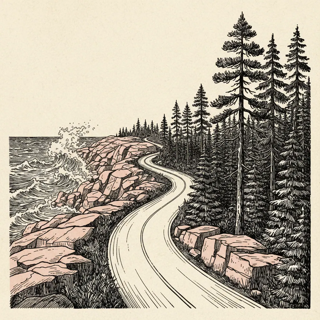
Mile 3–9: The Coastal Showpieces (Sand Beach, Thunder Hole, Otter Cliff)
This is the section everyone comes for. It’s also the section where the day’s plan succeeds or fails on timing. Sand Beach arrives at Mile 6. It’s the only true sand beach on the eastern side of Mount Desert Island, a pocket of crushed shell and quartz wedged between two granite headlands. The water sits in the low fifties through August, which is to say swimmable for about ninety seconds. Arrive before 9 a.m. or take the shuttle. Late afternoon, after 4 p.m., the lot also opens up as day-trippers leave. Thunder Hole is a mile further on, at Mile 7. The thunderclap (air compressed in a narrow chasm by an incoming wave, then released) only fires reliably in the window one to two hours before high tide. Outside that window, you’ll see a small inlet and a lot of disappointed visitors. Check the day’s tide chart before you commit. The walk down to the railing takes five minutes; the show, if conditions are right, takes another twenty. Otter Cliff at Mile 8 is the south end of the cliff drive. The face drops 110 feet to the water, which makes it one of the highest Atlantic headlands north of Brazil. Rock climbing parties work the south end most summer mornings. The parking lot is small. Expect to circle once or twice; if you can’t get a spot, push on and try again on the inland leg if you’ve got time.
Mile 9–15: Otter Cove to the Bubbles
The road bends inland here, and the character of the drive changes. Less surf, more pond and forest. Otter Cove at Mile 9 gives you a working harbor view across the water. Wildwood Stables, a mile beyond, is the operating stable for the carriage roads. If a horse-drawn carriage tour is on your list, book it through Carriages of Acadia in advance, because same-day walk-ups are unreliable in season. Jordan Pond House sits at Mile 12 and is the loop’s only restaurant. The popovers-and-tea-on-the-lawn tradition dates to the 1890s, when the original tea house operated on the same site. Reservations are essential for lunch on weekends, and the line for walk-up seating can run an hour past noon. If you’re not eating, the pond itself is worth the stop: the south end gives the canonical view of the Bubbles. The Bubbles, at Mile 13–14, are twin glacial domes, and the rounded shapes are textbook examples of how the last ice sheet shaped the island. The South Bubble trail is a roughly one-hour out-and-back, with a moderate climb to the summit and the perched glacial erratic known as Bubble Rock. The rock has been balanced there since the ice retreated about 14,000 years ago, which is a useful thing to remember when a small child wants to push it off.
Mile 15–27: The Inland Return and Cadillac Summit Turn-Off
From the Bubbles, the road turns north for the inland return. Eagle Lake at Mile 17 is a paved carriage-road junction more than a viewpoint, since the lake itself is partly screened by trees from the road. The carriage roads are excellent biking and walking, and dawn is the window for moose, if a moose is on the day’s wishlist. Realistically, white-tailed deer are the more common sighting, and you’ll see them throughout this leg. Bubble Pond is a small pull-off at Mile 19, easy to miss and worth the two minutes. The Cadillac Summit Road turn-off comes at Mile 22. Cadillac is the highest point on the U.S. Atlantic coast, and from October through early March it claims the country’s first sunrise. The summit road requires a vehicle reservation from May through October, booked through recreation.gov in two release windows. If you didn’t book one, you don’t drive up. (The trail up Cadillac from the North Ridge or South Ridge trailheads remains open without a reservation, but it’s a serious hike, not a roadside stop.) The final five miles back to Hulls Cove are the wildlife section. Deer in the early evening are common; fox at dusk is uncommon but real. Drive these miles with the windows down and the radio off. When you pull back into the Hulls Cove lot, your odometer should read close to 27, give or take, depending on whether you took the Cadillac spur. If you’ve spent four hours on it, you’ve done it about right. If you’ve spent six, you’ve done it the way the road wants to be driven. The next time you come, drive it the other way, meaning hike a piece of it. The Park Loop is the introduction. The carriage roads, the Beehive, the Precipice, the Sargent Mountain summit: those are the second visit, and they’re what makes the first one worth coming back from.